Latest News
-
Greece Halves Port Fees to Curb Ferry Costs Ahead of Summer Season
-
Delphi Economic Forum X 2025 – FT Journalist Alec Russell Talks Ukraine, Populism and Trump (video)
-
The Final Frontier
-
Death Toll Nears 200 in Dominican Republic Nightclub Disaster
-
Explaining Greece: Inside the Ancient Agora
-
Greece Risks EU Funding Cut as Frontex Probes Migrant Pushback Abuses
-
EU Pauses Tariffs Against U.S
-
Aid Cuts Threaten Global Maternal Health Gains, UN Warns
-
TO BHMA International Edition at Delphi Forum X 2025 – Can Europe Save Itself? (English)
-
TO BHMA International Edition on the Ground at Delphi
-
Von der Leyen Welcomes Trump’s Tariff Pause
-
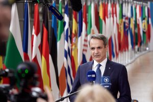
PM Mitsotakis to Breitbart: Greece a Strategic U.S. Ally, Calls for ‘Win-Win’ U.S.-EU Trade Deal
-
Giannis Gaitatzis: The One-Shoe ‘Iron Man’
-
Vassilis Torosidis: A Boy Reaches for the Stars…
-
Shipping’s Evolving Regulatory Landscape
-
Santorini Embraces Authenticity to Elevate the Travel Experience
-
Alter Ego Media Group: 2024 was a year of impressive financial growth
-
Before Napkins, the Greeks Used Bread Crumbs to Wipe Their Hands
-
Escalating U.S.-China Trade War Rattles Global Markets Despite Temporary Tariff Pause
-
Thursday Weather: A Flirt with Spring… But Don’t Pack the Jacket Yet
-
How NATO Patrols the Sea for Suspected Russian Sabotage
-
Delphi Forum: Athens Not Yet Affected by Overtourism, Says Mayor
-
Greek FM at Delphi Economic Forum X: ‘Greece-Cyprus Cable Project Moving Forward’
-
Air Force Exercise Iniochos 2025 in Greece Brings 14 Countries Together
-
Greece Fails to Absorb 97% of EU Funding for Hydrogen