While firefighters continue their efforts to contain large Athens wildfire fronts raging across the wider area of the Greek capital, NASA released a satellite photo revealing the size of the blaze.
According to the NASA satellite maps, the thermal force of the Athens wildfire suggests the front has exceeded 20 kilometers. Firefighters battling the flames on the ground estimate the front has reached up to 30 kilometers.
The NASA image shows scattered hot spots burning across the affected areas with the flames appearing to reach 25 meters in height at some points of the line. While firefighters continue to operate forceful winds blowing up to 8 Beaufort in northeastern Attica are hampering their efforts.
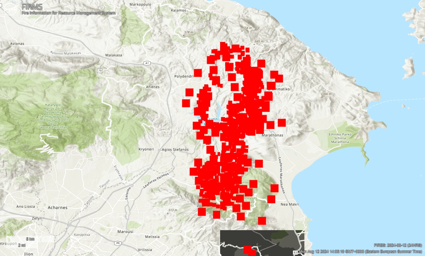
Currently, there are three main fronts: in the town of Grammatiko in the Marathon municipality, Mt. Penteli, and the east Attica town of Nea Makri.
The wildfire front was burning forestland, shrubs, and other mixed greenspace areas along a front extending from Mt. Dionysos to Mt. Penteli, with the latter overlooking the greater Athens area from the north.
Some reports had other fires springing up throughout the night in rapid succession around both peaks: Dionysos and Penteli, both areas repeatedly burned in the past by similar blazes.