Rain, storms, and a significant drop in temperatures are forecast for this weeked in Greece, with the change in weather brought by the arrival of Storm Boris.
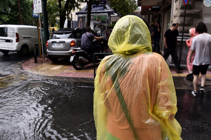
The foul weather comes on the heels of storm ATENA, which brought flooding to several parts of Greece the past few days.
The impact from a new low-pressure system called Boris will start to be felt on Friday and promises to bring some rather intense weather with it.
“Starting Friday, a new low-pressure system named ‘BORIS’ is expected to bring a new wave of rain and storms, particularly in western Greece. Additionally, temperatures will drop by 6-8 degrees Celsius, while winds will intensify, blowing from the west and northwest at speeds reaching up to 7 Beaufort.”
The Calm Before the Storm
Thursday promises to offer a brief respite from the bad weather.
According to the National Meteorological Service (EMY) forecast for today, local showers or storms are expected in the northern and eastern Aegean islands, the Dodecanese, and temporarily in Crete until the afternoon.
In the rest of the country, the weather will initially be mostly clear, with some local clouds forming in the Ionian and western mainland areas by midday. In the evening, isolated storms may occur in the northwestern regions.
Winds in the west and south will blow from westerly directions at 3 to 5 Beaufort, and from southerly directions in the east at 3 to 4 Beaufort.
Temperatures will rise slightly, reaching 28-29°C in the north and 29-31°C in the rest of the country, with some areas experiencing temperatures up to 32°C.
Detailed Forecast from EMY:
MACEDONIA, THRACE
Weather: Generally clear with occasional clouds, especially in western Macedonia in the evening.
Winds: Variable, 3-4 Beaufort, with southerly winds in the south during the afternoon.
Temperature: 16-28°C, locally reaching 29°C. In western Macedonia, temperatures will be 3-4°C lower.
IONIAN ISLANDS, EPIRUS, WESTERN CENTRAL GREECE, WESTERN PELOPONNESE
Weather: Generally clear with some local clouds. By midday, clouds will increase in the Ionian and western mainland, with local showers or storms. In the evening, isolated storms may occur in the northwest.
Winds: West-northwest at 3-4 Beaufort, shifting to west-southwest in the Ionian, reaching up to 5 Beaufort.
Temperature: 18-30°C, locally up to 32°C in the south. In the interior of Epirus, temperatures will be 3-4°C lower.
EASTERN CENTRAL GREECE, EVIA, EASTERN PELOPONNESE
Weather: Generally clear with some local clouds, especially during the afternoon.
Winds: Westerly at 3-5 Beaufort, gradually becoming variable at 3-4 Beaufort.
Temperature: 20-31°C, locally up to 32°C.
CYCLADES, CRETE
Weather: Mostly clear in the Cyclades. In Crete, partly cloudy with occasional local showers, mainly in the mountains during the afternoon.
Winds: Westerly at 3-5 Beaufort.
Temperature: 22-30°C, locally up to 32°C in Crete.
EASTERN AEGEAN ISLANDS, DODECANESE
Weather: Initially cloudy with occasional showers or storms in the north, clearing up later in the day.
Winds: Southerly at 3-4 Beaufort in the eastern Aegean, westerly at 3-4 Beaufort in the Dodecanese.
Temperature: 21-30°C.
THESSALY
Weather: Generally clear with occasional clouds.
Winds: Variable at 3-4 Beaufort, occasionally southerly in the afternoon.
Temperature: 18-30°C.
ATTICA
Weather: Generally clear with some clouds in the afternoon.
Winds: Westerly at 3-5 Beaufort, occasionally shifting to southerly at 3-4 Beaufort in the south during the afternoon.
Temperature: 20-32°C.
THESSALONIKI
Weather: Generally clear.
Winds: North-northwest at 3-4 Beaufort, shifting to southerly during the afternoon.
Temperature: 18-29°C.
Source: TO VIMA