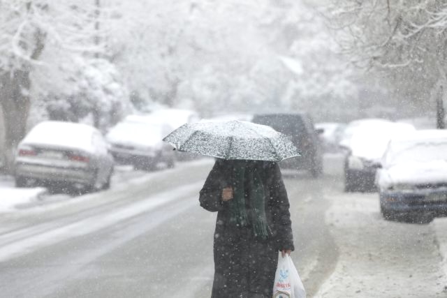
Don’t be fooled by the spring-like weather that greeted Athens on Tuesday morning—a severe winter storm is on the way. The Hellenic National Meteorological Service (EMY) has issued an Emergency Weather Deterioration Bulletin, warning of plunging temperatures, powerful storms, and widespread snowfall across the country by the afternoon.
Heavy rain and storms will begin in Thrace by mid-morning, spreading to Chalkidiki, Thessaly (mainly Magnesia), the Sporades islands, Evia, Phthiotis, and Boeotia by the afternoon. Snowfall will first hit mountainous and semi-mountainous areas of Macedonia, Thrace, and Epirus, later extending to lower elevations in these regions. By late afternoon, snowfall will spread to Thessaly, Evia, Evrytania, Phthiotis, and Boeotia, covering even lowland areas.
Winds will strengthen, with northerly and northeasterly gusts reaching 8 to 9 Beaufort in the Aegean Sea and eastern mainland from the afternoon. Temperatures will plummet by 8 to 10 degrees Celsius, with the cold snap first affecting the north before moving south by evening.
According to EMY, increasing cloud cover, rain, and sporadic storms will intensify throughout the day, becoming strongest in Thrace and Chalkidiki. By late afternoon, severe weather will expand across the mainland, the Sporades islands, Evia, the Cyclades, Crete, and the Eastern Aegean, with intense storms expected in Thessaly, Magnesia, the Sporades, Evia, Phthiotis, and Boeotia.
A hard freeze is expected in northwestern Greece overnight. Snowfall will spread south, affecting mountainous, semi-mountainous, and low-altitude areas in Macedonia, Thrace, Epirus, Thessaly, Evia, Evrytania, Phthiotis, and Boeotia before conditions ease in the west and north by nighttime.
Winds will shift to northerly and northwesterly at 4 to 6 Beaufort, increasing to 7 Beaufort at sea. By evening, the Aegean will experience 8 to 9 Beaufort winds, while the Ionian will see 4 to 6 Beaufort winds.
Temperatures will plunge, with highs only reaching 9-11°C in northern Greece, 14-16°C in the mainland and Ionian, and up to 20°C in Crete and the Dodecanese. A severe frost is expected in northwestern Greece overnight.
Regional Weather Conditions
-
Macedonia & Thrace: Overcast with localized rain and storms, strongest in Thrace and Chalkidiki. Heavy snow is expected in mountainous and semi-mountainous areas, extending to lower elevations later in the day. Winds northerly at 4-6 Beaufort, increasing to 7-8 Beaufort in the east. Temperatures 1-11°C, with colder conditions in Western Macedonia.
-
Ionian Islands, Epirus, Western Central Greece, Western Peloponnese: Cloudy with rain and storms. Snowfall initially in mountainous regions, later spreading to semi-mountainous areas, particularly in Epirus. Winds northwesterly at 4-5 Beaufort, reaching 6-7 Beaufort in the northern Ionian. Temperatures 5-17°C, with colder conditions inland.
-
Eastern Central Greece, Evia, Eastern Peloponnese: Cloudy with rain and storms, strongest in Evia, Phthiotis, and Boeotia. Heavy snow expected from late afternoon in mountainous and semi-mountainous areas. Winds northwesterly at 4-5 Beaufort, increasing to 6-8 Beaufort in the east. Temperatures 7-17°C.
-
Cyclades & Crete: Mostly sunny early, with increasing clouds and rain by afternoon. By evening, scattered storms are expected. Winds northwesterly at 4-6 Beaufort, strengthening to 7-8 Beaufort. Temperatures 12-20°C.
-
Eastern Aegean Islands & Dodecanese: Overcast skies increasing, with localized rain in the northern Aegean from late morning and rain spreading to the Dodecanese by evening. Winds northerly at 4-6 Beaufort, increasing to 8-9 Beaufort in the north. Temperatures 10-20°C, cooler in the north.
-
Thessaly: Overcast with rain and storms, strongest in Magnesia and the Sporades. Heavy snowfall from late afternoon in mountainous and semi-mountainous areas, extending to lower elevations. Winds northwesterly at 4-6 Beaufort, increasing to 7-8 Beaufort in the Sporades. Temperatures 4-14°C.
-
Attica: Increasing clouds with rain and storms from early afternoon, including snowfall in the mountains by evening. Winds northwesterly at 4-5 Beaufort, shifting to northeasterly at 6-8 Beaufort in the east. Temperatures 8-16°C.
-
Thessaloniki: Cloudy with rain and storms, strongest near coastal areas. Heavy snowfall expected in mountainous regions, later reaching lower elevations. Winds northerly at 4-6 Beaufort, increasing to 7 Beaufort by evening. Temperatures 5-11°C.