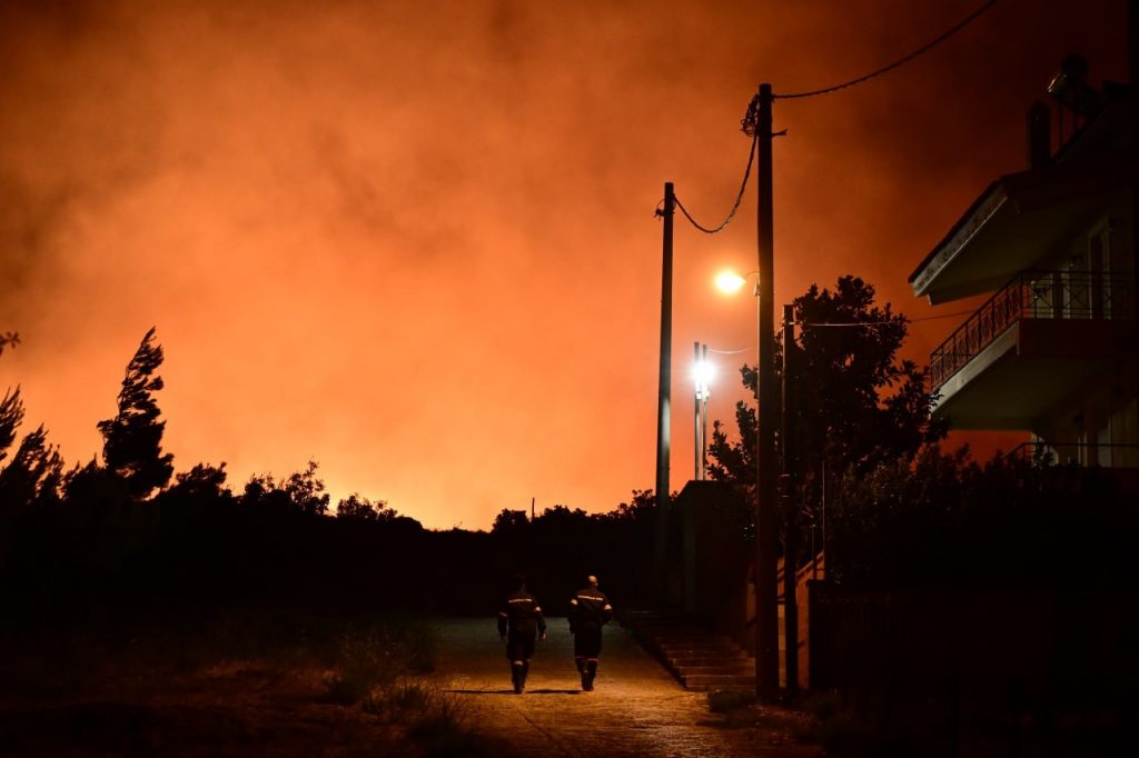
A devastating wildfire that erupted in Attica on Sunday, August 11, claimed one life, destroyed hundreds of homes, and scorched over 100,000 acres of land.
By Monday afternoon, Meteo.gr reported that the burned area had already reached approximately 100,000 acres after the fire, which began in Varnavas, northeast of Athens, rapidly spreading to multiple regions, including residential areas in the capital. This figure is expected to rise as the fire continued to rage in several scattered locations through Tuesday.
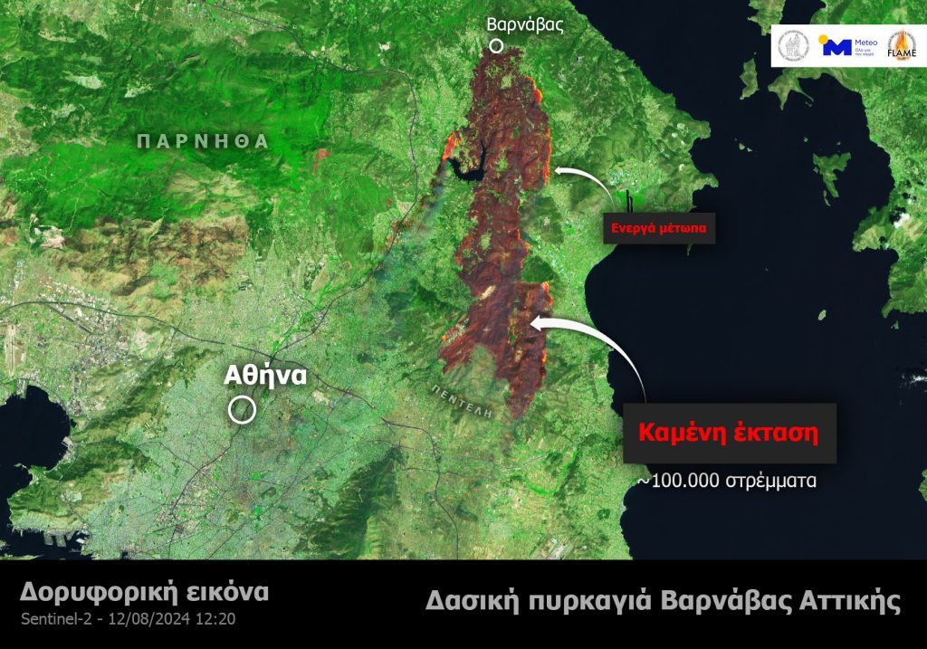
The fire front extended for 23 kilometers – The Copernicus map
The wildfire in Attica spanned a staggering 23 kilometers, according to a map released by the European Copernicus service. Firefighters were faced with the daunting task of battling 168 active fire fronts as the blaze spread rapidly across the region.

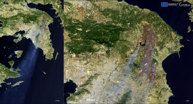
How the Fire Spread – The Extent of the Smoke
A satellite image from Copernicus Sentinel-2, captured on August 12 at 12:05 p.m., shows the wildfire burning just a few kilometers from the center of Athens.
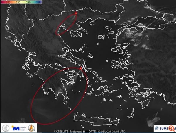
A satellite image from the European weather satellite METEOSAT-11, shared by the National Observatory of Athens’ Meteo.gr, vividly captures the extensive spread of smoke from the wildfire in northeastern Attica.
The smoke traveled southwest for more than 300 kilometers, according to Meteo’s estimates. The image also highlights the smoke dispersal from the forest fire on Mount Menoikion (Menoikeion) in Serres, northern Greece
37% of Attica’s Forests Burned in the Last 8 Years
An updated analysis reveals troubling data about the extent of forest fires in the mainland part of the Attica region over the past eight years (2017-present).
Reports from the Copernicus Rapid Mapping Service and the European Forest Fire Information System (EFFIS), analyzed by Meteo.gr, show that 13 major wildfires since 2017 have ravaged more than 700,000 acres of forest, underscoring the severe impact of these disasters on the region.

The Attica region, covering 2.5 million acres (excluding Troizinia, the islands, and the Athens basin), has seen 26% of its total area burned by wildfires over the past eight years.
Within Attica, which has approximately 1.23 million acres of forested land, 450,000 acres—37% of the total forest area—have been scorched in the same period.
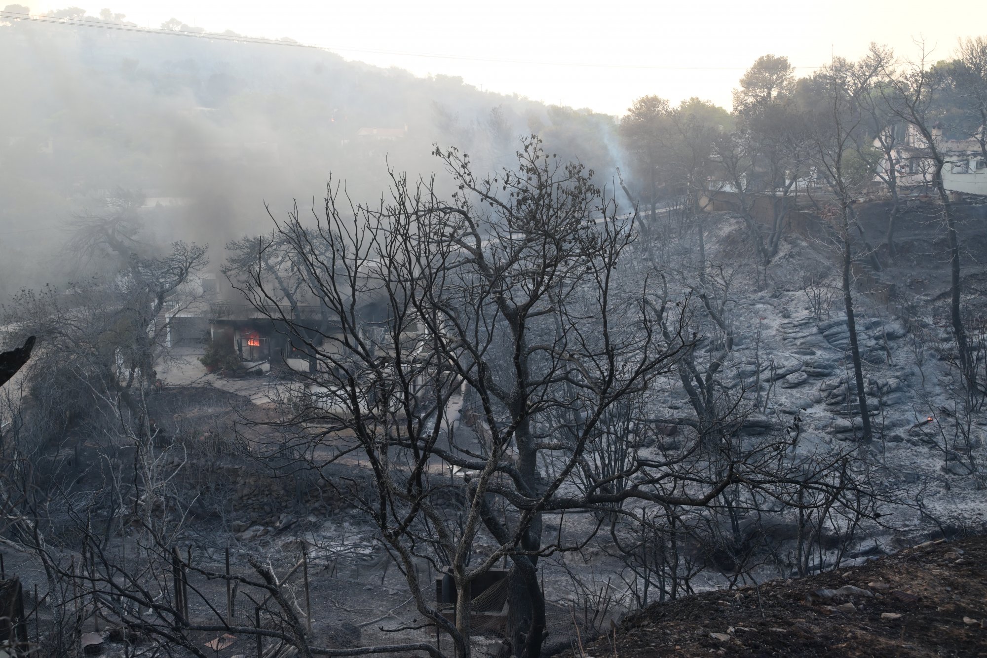
The recent wildfire that started in Varnavas and advanced into the residential zones of the Athens basin has devastated a large segment of the forested landscape in northeastern Attica.